6/29 Yorkshire Dales - Driving to Ayesgarth Falls Visitor Center

Today, I drove to the visitor center near Ayesgarth Falls in the Yorkshire Dales.  I have never been in the Dales before, and i wanted to compare them to the North Yorkshire Moors.  A quick summary is that the Dales:

  • Are more rocky 
  • Have slightly steeper hills
  • Are more fenced-in so almost no sheep on the roadways
  • Have trees here and there, though still fairly bare

Both areas primarily have shale and limestone as their bedrock, and this stone was commonly used in both areas for building houses, barns, and fences.  Overall, the land has been soggy and peat grew up in the acidic soil, forming deep peat bogs, upon which heather and few other plants grew.  

Both areas also have in common that the soil is poor and lacks nutrients to form good farmland, hence the areas have been used for sheep for several centuries.  Early farmers, however, learned to farm the valleys, but the higher ground stayed bare and rocky.  While there were forests in the valleys where people lived, the sheep became the primary residents of the higher areas, and over several centuries this resulted in a proliferation of mostly those things which sheep do not like to eat!  They do occasionally burn the moors to rid it of unwanted and foreign plants.  

So, basically sheep have thrived on the moors and made fortunes for people over the centuries, but not much else but sheep can thrive on the higher, more rocky areas.  You will see cattle and other farmed crops in the valleys, however, and that is where most of the villages and homes are located. 

The drive today was a little better than a couple of days ago, but much rougher than driving in the North Yorkshire Moors for a couple of reasons:  1) roads were not so busy, and 2) there are fewer fences in the moors so it is easier to pull over.  

Similar to the moors, the roads today were almost all 4-digit roads.  

 
I need to remember not to do a lot of driving on Sundays because there are always more motorcyclists on the roads on those days, and more local families out for the day also.  There was actually more traffic than these photos show because I could not take photos in traffic safely.  At least this road was wide enough to have a line down the middle.  

 
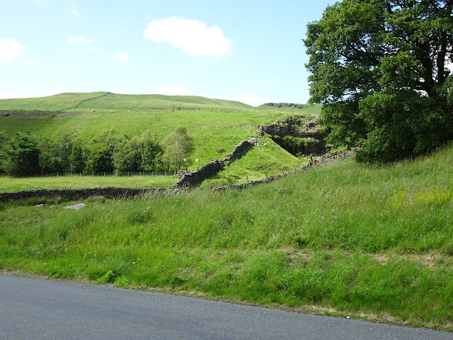
Looks similar to the moors, but more stone walls to run into.  


A lot of streams and bridges, as well, that I did not see as often in the moors. 


Stopped at this small town for some ice cream!   

 
Look at the color of this water!  The brown color is due to peat.   

More trees than the moors.  


I was surprised to see this waterfall, but notice how it the water is falling over a rocky cliff which you will not find in the moors.  


And another, though smaller, waterfall.  

 
Love to see roads in the distance. Gives you a perspective of size and distance.  


Finally made it to the visitor center and got parked.   


As I was getting ready to head to the falls, these guys showed up in costumes.   It took me a while, but I recognized them as Morris Dancers.  They are trying to keep alive a kind of ancient British dancing that is several centuries, if not a few millennia, old.  I did some quick research and found that the name "Morris" is probably a corruption of "Moorish" dancing.  
 

The had bells tied around their ankles and wore knee-length pants with decorative socks. Click on this link to view one of the two videos I took.   https://youtu.be/OlR7sQ45bfU

These are also Morris Dancers, but with costumes festooned with ribbons.  

 
And here is a video of the ribbon dancers dancing.   https://www.youtube.com/watch?v=QSu5BeexpPY


It was nice to have some historical entertainment, even if it was in a parking lot and cars had to squeeze by!  If you want to know more about this ancient dancing, check out this site:  https://en.wikipedia.org/wiki/Morris_dance
 
Next I headed to one of three sets of waterfalls--the Upper Falls in this case.  It would have been a long walk to all three, but this was enough for my long day.   

 
More photos of the Dales and my drive back to my camping pod.  Notice how the stone fences go a long way into the hills, so sheep are pretty much contained.   


 Tomorrow, I head to Chester in Wales.  

6/27 Bronte Sister's Home

Today I was going to drive from my last hotel in Harrogate to a new location--a luxury camping pod at a sheep farm at the edge of the Yorkshire Dales.  However, I noticed that the town of Haworth was not too far out of the way, so I decided I had plenty of time to stop there on the way.  

The road started out great--not too much traffic and an easy drive.  Unfortunately, that did not last long.  It was only a 30 mile drive, but as I got closer to Haworth, the route took some ridiculous shortcuts through some narrow country roads and then through a hillside collection of homes and through a couple of tiny towns.  Following is the first easy drive, and then the horrible shortcut.   

 
It started to get bad a little before this photo below when i missed a turn and did a couple of circles trying to get back on track.  I could not take photos of the entire route because I had to watch out for stone walls and sharp turns.  


At this point below, I was sure I was on the wrong route, but no, that's where my GPS wanted me to go--through people's back parking areas!

 
You've got to be kidding that I am supposed to go past this white car and down that stone path!!!  And that white car is even sticking out a little.  

 
The next turn was left through this narrow alley.   

 
And down whatever this road is.   

 
It got a little wider here, but it did not last.   
 
 
Made it to the Bronte parsonage, but my trusty GPS, told me to turn down this road for parking.  Ha! 

 
And it got narrower and narrower, but no place to turn around.  Had to keep going.   

 
OK, which path would you take, right or left? I ended up going left because it looked a bit wider.   

 
Passed the Bronte church.  

 
And some shops.  Plus a lot of pedestrians.  Glad to at least see another car there so I knew it was technically a real road.  

 
And down the road, the pedestrians parting as I drove past.  


Still not to the end.  
 
 
Someone who knew where they were going, or another lost soul? 


No photos, but I finally got to the end, drove around the block and discovered the parking lot where I should have parked in the first place.  Whew!  Below is a photo of the inside of the church where the Bronte father was the minister.   

 
To the right of this photo is the church cemetery and the church in the distance.  I took this photo from the entrance to the Bronte yard, so you can see how close the parsonage was to the church.  Since the church was facing the little village I drove through, you can also see how short a distance it was for the sisters to walk there.  

 
 The entrance to the Bronte home. 
 
 
The front of the parsonage faced the church and cemetery.   The left side of the house is where the family lived, and the right part was built after their deaths, so it was a bit newer, although it does not look so. 


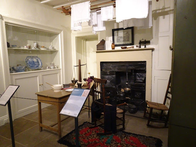
The downstairs consisted of four rooms, two on each side of a central hallway.  The rooms were the kitchen, dining room, father's study, and a room with a piano.   


Upstairs were four rooms that are assumed to be a room or two for the girls, one room for a servant, and a playroom when the girls were younger.  Following are some of their belongings displayed in the rooms.  

 
Of the sisters, Charlotte was the one who had very poor sight, and here are the glasses she wore.  She had to be very close to the paper as she wrote all of her books.   

 
And the father's bedroom.  The bed is a replica of one he designed and had built but no longer exists.  


 A painting of the sisters and their brother.