Nearly everyone has heard about Stonehenge, and a few more have heard of the Avebury Stone Circle, but there is a lot more to see in this area of England. The prehistoric people who built Stonehenge, also built several other structures in the area that are closely tied together, only one of which was what we call Stonehenge. All of these were constructed at about the same time--4000 BC to 3,000 BC.
I will write about Stonehenge tomorrow, but on this day, and part of the next, I focused on visiting four of them. I could walk among only two of them, but took photos of the other two. The one I wish I could have visited was the West Kennett Longbarrow, but the day was very hot, and it is a substantial walk across fields to get to this one, so I had to pass on it. I will, however, post some information on it at the end in case anyone wants to investigate this one in more detail.
Actually, I was able to view each of these four sites as I drove from my hotel in Amesbury, on my way to Avebury. (I skipped Stonehenge on this trip because I had visited it twice in the past few years.) In addition, I briefly visited a small museum about the area in Amesbury the morning before I headed out, so I will include a couple of photos here:
This below is a reconstructed hide boat made by some local people, based on what they believed such boats used then might have looked like:
Woodhenge
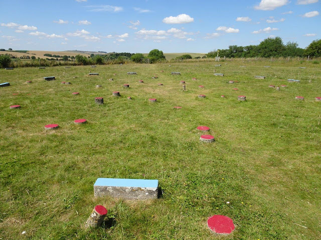
Obviously, wood does not last as long as stone, so archeologists determined the placement and size of each of these stones from the size and locations of the changes in the color and soil in the holes that remained. They placed cement indications of the location of each hole and painted the tops of each in a different color to make the several different circles more evident.
The first photo shows the center of the circle, and the second was taken from the edge of the circle.
Click on this link to get more information about this site from English Heritage: https://www.english-heritage.org.uk/visit/places/woodhenge/
The Sanctuary
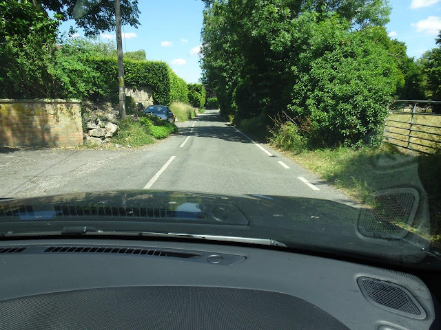
Some of these not-as-well-known sites require narrow country roads, such as the one shown below. No wonder tour buses don't often come here! The top photo shows a slightly wider than usual country road that is supposed to be a two-way road.
The problem occurs when another car comes toward you. One or both of you have to pull over until the shrubbery or tall grasses rub against your vehicle. This also sets off your system that warns you when you are too close to something.
Silbury Hill
The Avenue
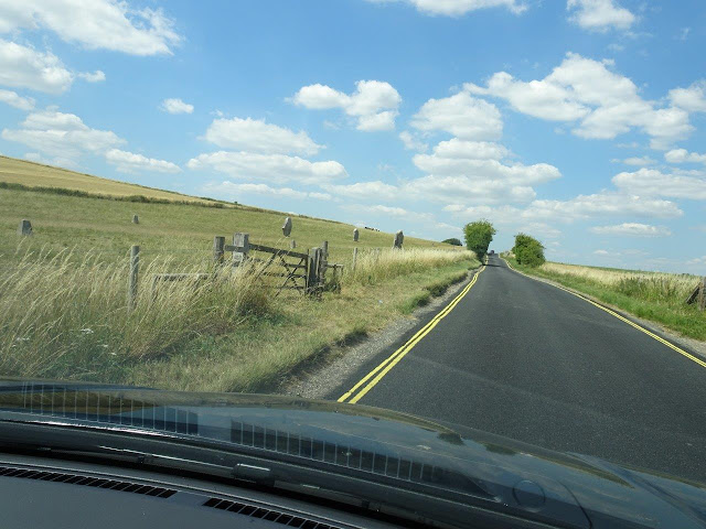
The Avenue is a path with stones on either side leading from Avebury to Silbury Hill and the Sanctuary. Unfortunately, it is located on a very narrow road, and they have closed off the only parking area along the road. I drove along it twice, trying to get photos through my front window and hanging my arm and camera out of my driver's side window.
Note that they have put double yellow lines along both sides, indicating no parking!!! And those cones are cement and buried in the dirt, so there is no driving over or around them!
In addition, the British road builders also do not believe in having shoulders you can pull over on! I saw a couple people hiking from Avebury, which is not too far away, but it was much too hot for most people to walk that far.
And again, more information on The Avenue is available at these two sites: https://www.english-heritage.org.uk/visit/places/west-kennet-avenue/ and https://www.english-heritage.org.uk/visit/places/west-kennet-avenue/history/


No comments:
Post a Comment